Services / Aerial Mapping

[maxmegamenu location=max_mega_menu_1]

Aerial photogrammetry can create digitized, high-resolution 2D or 3D models that can be used to track construction progress, inventory stockpiles, assist with asset management and more!

Mapping examples coming soon

Uses & Benefits

Icon of stopwatch

Time-Efficient

Traditional, ground-based mapping takes a considerable amount of time. Drones capture all the necessary data faster and provide deliverables with a quicker turnaround time.
Icon of paper and tray

Mapping Data & Quality

Advanced drone cameras can take photos that can create millions of data points, elevation points, and colors. This data can create high-resolution orthomosaics, 3D models of a site or building, while allowing clients to see more than what a traditional survey provides.
Icon of dollar sign

Cost-Effective

Save on equipment and labor costs while getting the high-quality images and data you need to make critical decisions and monitor a job site remotely.
Icon of ruler and pencil

Stockpile Measurements

With a commercial drone, a high-quality camera and a robust processing application, we can deliver stockpile measurement reports that contain volumetric data to track stockpile inventory.
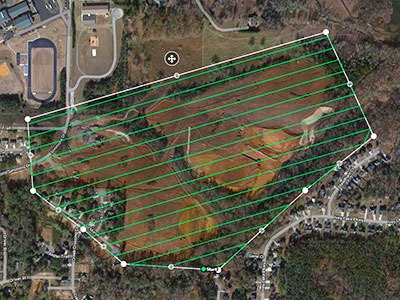
Image of flight path for a mapping project
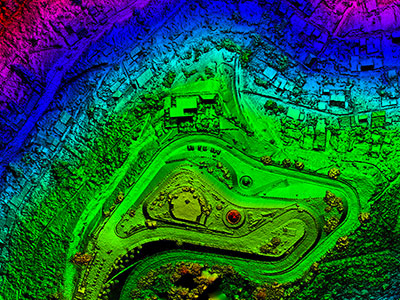
Aerial image of a topographical map
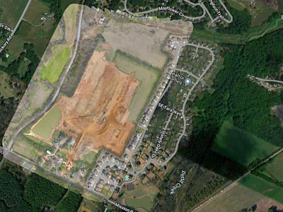
Image of a map of a site under construction

Icon of a pilot badge

Certifications & Insurance

Our pilots are Part 107 certified by the Federal Aviation Administration. We also carry UAV insurance with the ability to provide our customers with a COI (Certificate of Insurance) upon request.

We are a DBE-certified business in the state of Georgia since 2017.

Icons of FAA, DBE and GDOT logos

The Georgia Drone logo
The Georgia Drone
1220 Mecaslin St., Atlanta, GA 30318
404-980-7080
fly@thegeorgiadrone.com
Part 107 FAA-Certified | Certified DBE | Fully-insured
     
Copyright © 2021 The Georgia Drone, LLC . All Rights Reserved.